Bringing People to the Parks
The Goal
Located in downtown Columbus, OH, the Scioto Mile is an expansive urban park space composed of nine different parks. It runs along the Scioto River, passing by various city attractions and landmarks, and offering a plethora of activities to users. Though it is a treasured space by the city of Columbus and nearby residents, the Scioto Mile is underutilized.
For my senior thesis project, I chose to focus on how to improve the visitor experience at the Scioto Mile. This semester-long process included user research, rebranding, interactive wayfinding, and a mobile app.
Research
Through research, my goal was to understand the Columbus identity, place branding, what makes parks successful, and what people want from the Scioto Mile. Using these insights, I could then identify ways to encourage more people to visit the area.
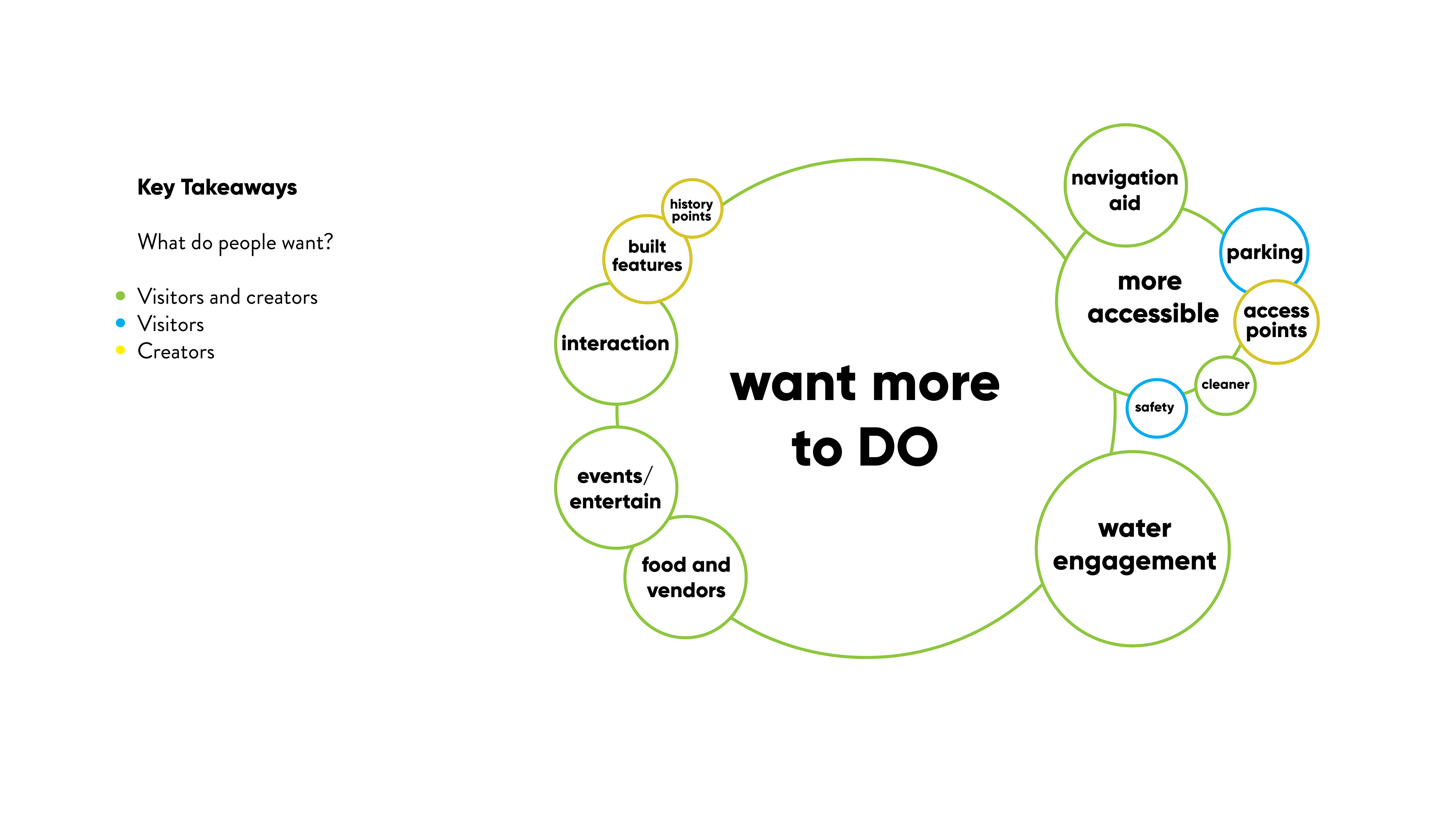
In conclusion: people love the Scioto area, but they want more to do, and are not fully aware of what amenities are available to them at the parks. This comes from a lack of attention being brought to the Scioto Mile features, and a lack of navigational aid relative to the area.
Brand Identity
The Adventure Columbus Scioto Mile brand is organic, flowing, and invigorating. It is reflective of the motion of the Scioto River, the people moving through the parks, and the constantly moving city.
The mark is composed of nine segments, one segment for each of the nine parks that make up the Scioto Mile.
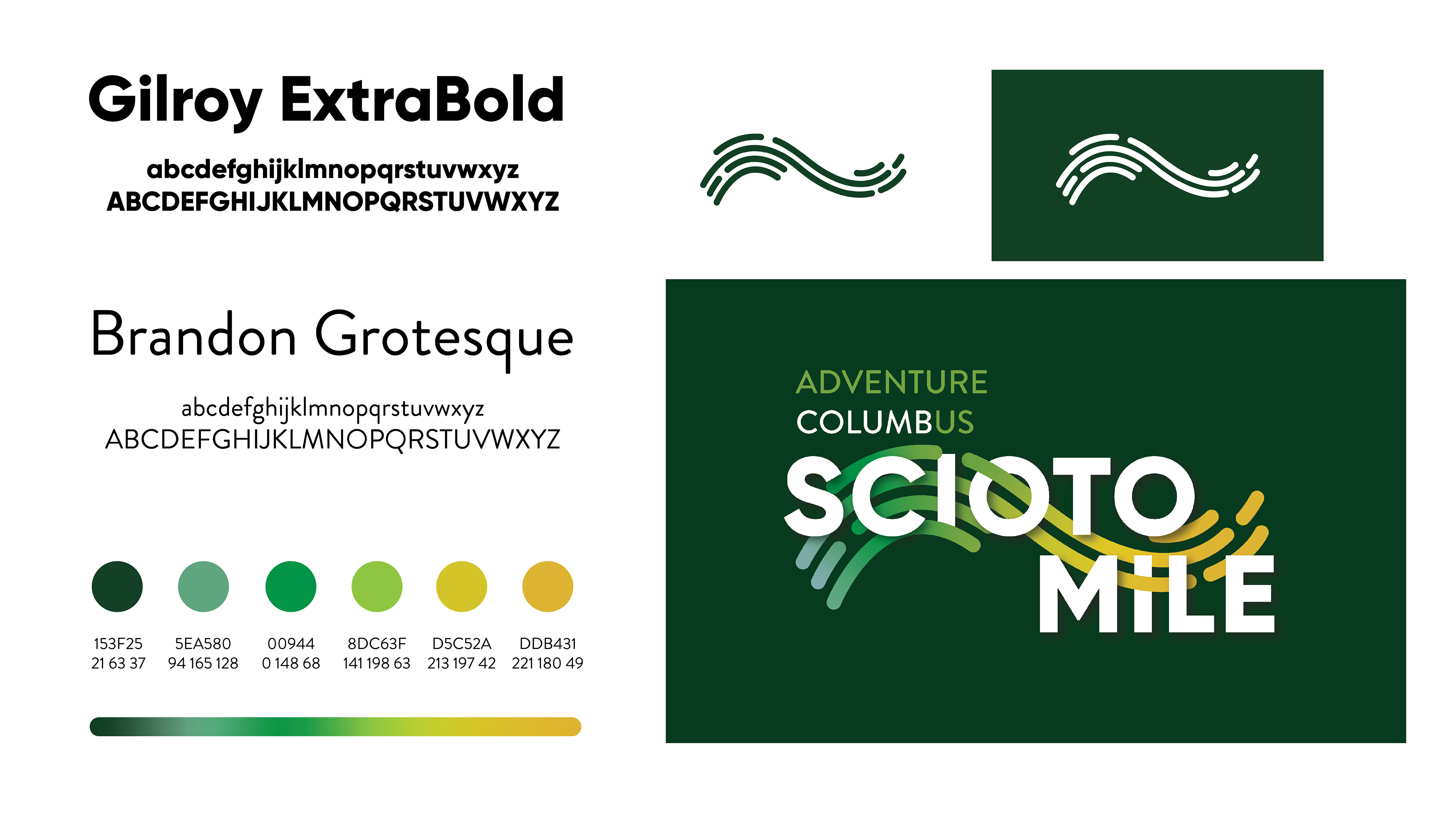
The individual segments of the mark could potentially be taken apart and incorporated into signage for each of the nine parks.
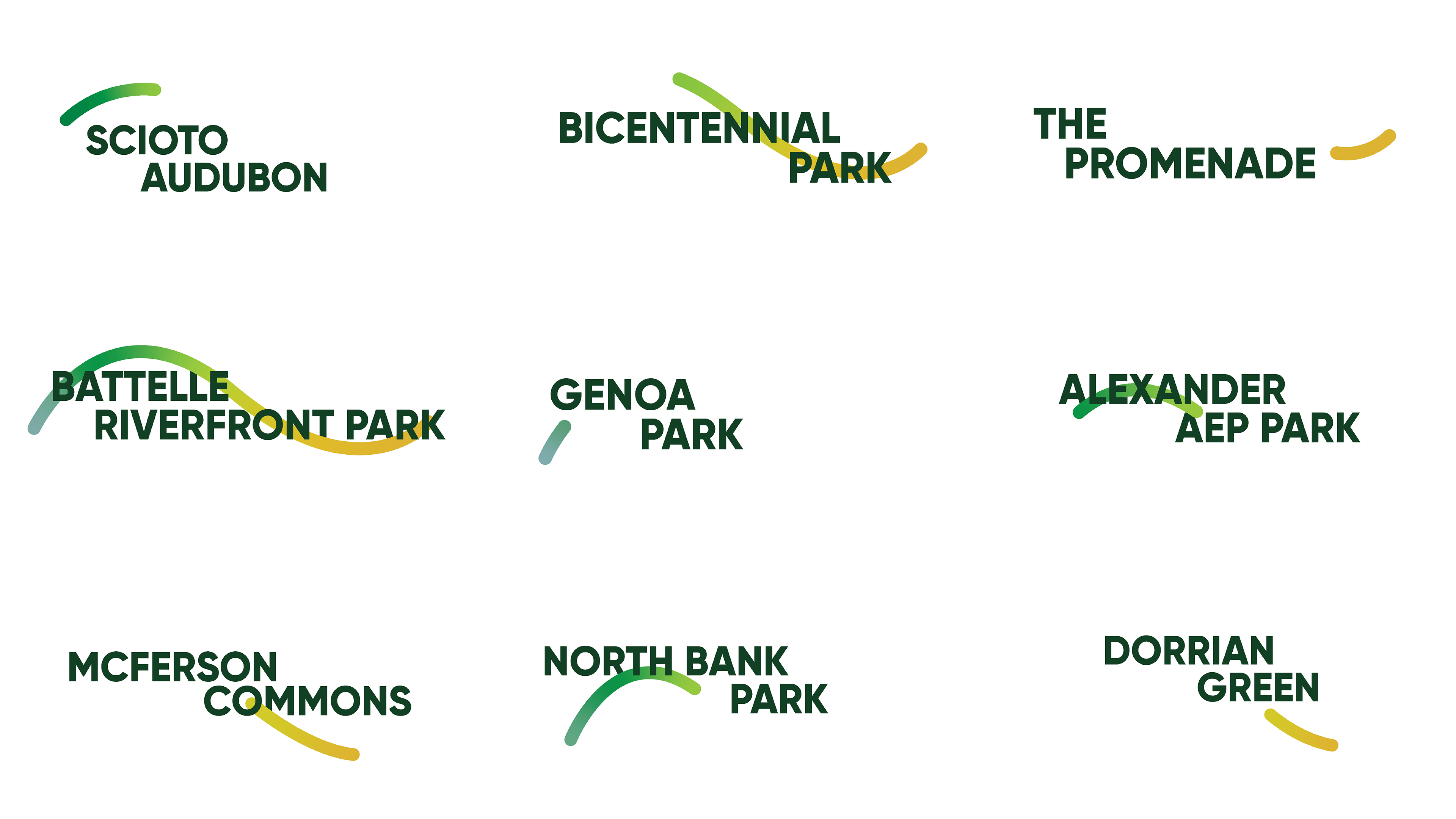
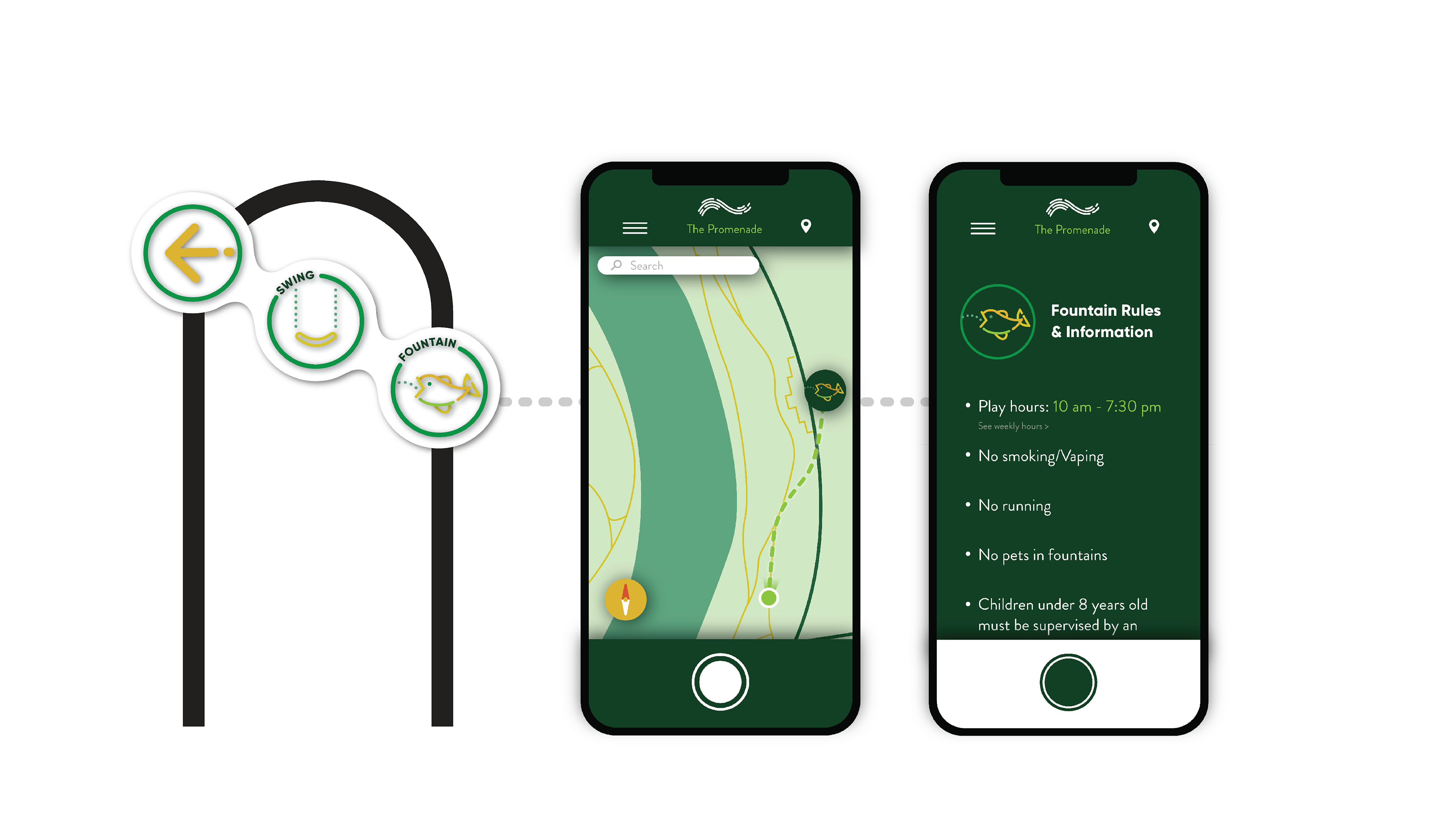
The icon system displays some of the Scioto Mile’s most popular features. These are incorporated into digital maps and signage as destination points.

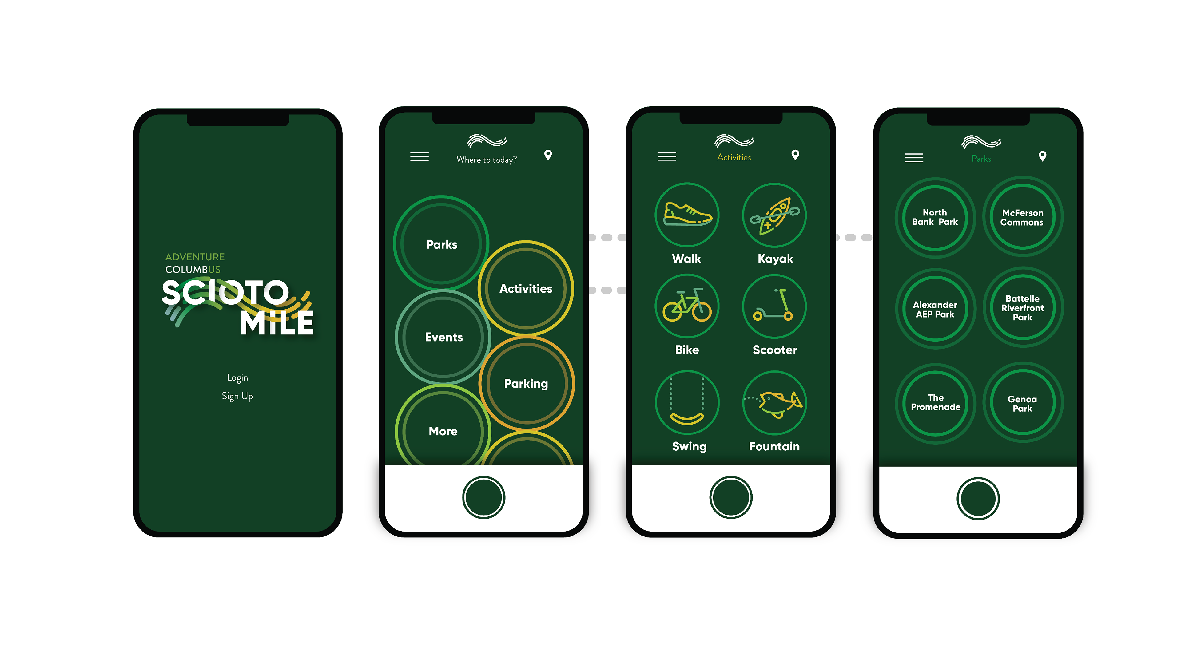
Mobile App
The mobile app can be used to find any and all information about the Scioto Mile. Users can access park locations and information on individual parks, activities, and features.
The look and feel of the mobile app uses the colorful, stroke-based look of the icons while leaning more into a natural feel over urban.
Interactive Wayfinding
Use the mobile app in tandem with the signage at the Scioto Mile to immediately access interactive maps and relevant information.
Park maps can be scanned and become an interactive map on the mobile app. On the interactive map users can get directions to desired activity points and parks.
Activity signs can be scanned to pull up maps directing users to the specified activity, or pull up information about the specified activity.

Final Video
As a final deliverable, I created a short promotional video, highlighting the Scioto Mile through the use of my mobile app and wayfinding system. Footage used in the video was pulled from MKSK Studios Scioto Mile promotional footage.
Full Process Documentation
Check out the full process below. Thank you!